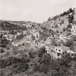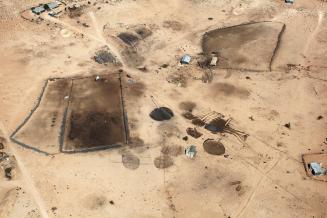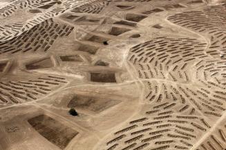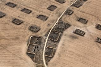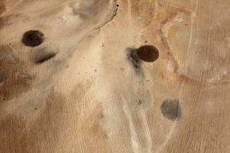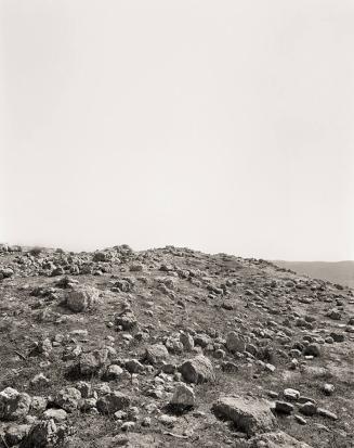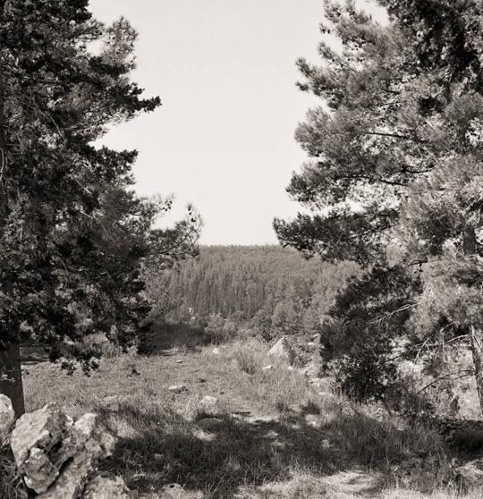
- Sūba, Jerusalem District, 31°47’6”N / 35°7’32” E
- from the series Memory Trace
Sheet: 35 15/16 × 27 9/16 in. (91.3 × 70 cm)
Explore Further
1948: Population 719; Houses 110
Occupation date: July 13, 1949
Occupying forces: Har’el Brigade
Post 1948: In October 1948 a group of veterans of the
Palmach established Kibbutz Misgav Palmach one kilometer southwest of the
former village. While the settlers wished for this name, a compromise was
reached with the Governmental Names Committee, which approved the name Palmach
Tsova, by which it was from thereon known. In the 1980s Tel Tzuba National Park
was established on village land in accordance with a National Master Plan for
national parks and nature reserves; it was run by the Israel Nature and Parks
Authority, and its signage provided by the Jewish National Fund (JNF, a
nongovernmental Zionist organization founded in 1901 for the purpose of buying
land on behalf of world Jewry for the foundation of a Jewish state in Ottoman-controlled
Palestine.
Today: A series of partially destroyed houses of the village
of Sūba is to be found on a steep hilltop beside a Crusader fortress within the
Tel Tzūba National Park. The village spring is a tourist site run by the nearby
kibbutz, which cultivates the surrounding fields of the former village.
Official Israeli name: Tsova (the ancient name of the site)
From the publication The
Erasure Trilogy, Volume I: Memory Trace (Göttingen:
Steidl, 2015).
ProvenanceThe artist; [Pace/MacGill Gallery, New York]; purchased by MFAH, 2017.
Inscriptions, Signatures and Marks
SUBA - JERUSALEM DISTRICT / MEMORY TRACE SERIES / 2012 / © (signature)
[no inscriptions]
Cataloguing data may change with further research.
If you have questions about this work of art or the MFAH Online Collection please contact us.