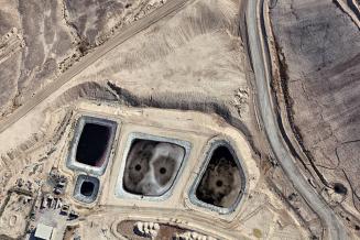
- Latitude: 31°18’50”N / Longitude: 34°40’58”E
- from the series Desert Bloom
Sheet: 20 1/2 × 28 1/4 in. (52.1 × 71.8 cm)
Explore Further
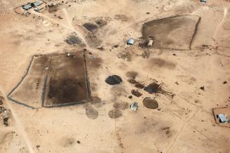
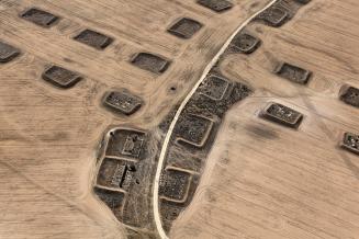
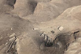
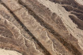
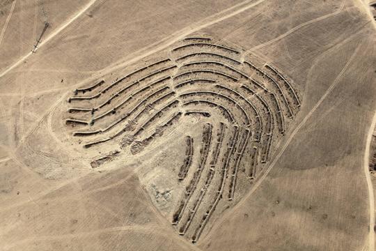
Plantation work for the Ambassador Forest organized by the
JNF, using the method of “savannization”: a mixture of sparsely scattered
acacia or eucalyptus trees with bushes and grass between, as found in the
savannah region. Irrigation comes from long terraces that collect rainwater,
optimizing the water retention. The fields around the planted area are
cultivated by Bedouins, and are distinguished by the shallow plowing or
“scratching” technique of cultivation. The small spots within the field show
where wheat was collected in previous years. The forest was planted atop the
Bedouin village of Abu ʽAbdūn, of the Tiyāha tribe, evacuated and destroyed in
the winter of 1948.
From the publication The
Erasure Trilogy, Volume 4: Desert Bloom (Notes) (Göttingen:
Steidl, 2015).
ProvenanceThe artist; [Pace/MacGill Gallery, New York]; purchased by MFAH, 2017.
Inscriptions, Signatures and Marks
Cataloguing data may change with further research.
If you have questions about this work of art or the MFAH Online Collection please contact us.