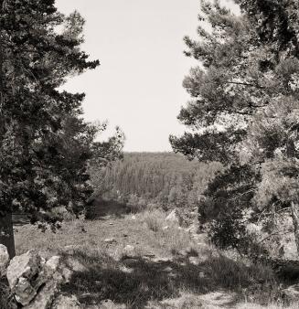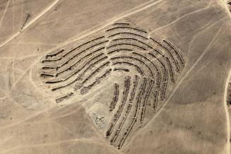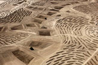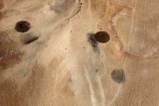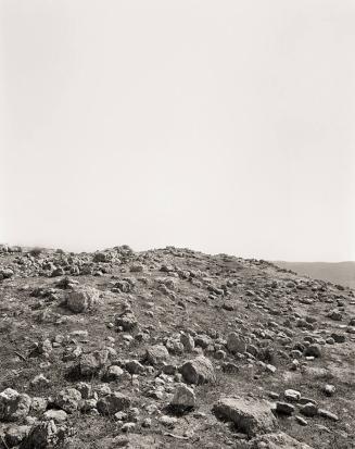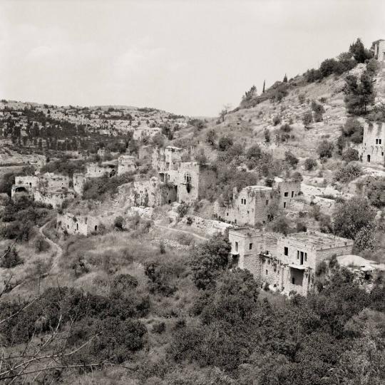
- Lifta, Jerusalem District, 31°47’46”N / 35°11’46” E
- from the series Memory Trace
Sheet: 35 15/16 × 27 5/8 in. (91.3 × 70.2 cm)
Explore Further
1948: Population 2,958; Houses 410
Occupation date: Attacked on January 29, 1948; depopulated
by early February.
Occupying forces: Leḥi (also known as the Stern Gang)
reprisals on the outskirts of the village; Haganah and Etzel military activity
in the vicinity
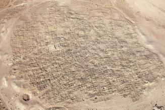
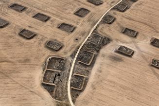
Post 1948: In February–March 1948 Jews evacuated from
front-line Yemin Moshe were resettled in empty houses in Lifta. In May of the
same year, Lifta was settled with Jews evacuated from ‘Atorōt, which had fallen
to the Jordanians, and later with immigrants from Yemen and Kurdistan. By the
1960s, most of the aforementioned had left. In 1950 Lifta was annexed to the
municipality of Jerusalem. The Giv’at Sha’ul neighborhood of Jerusalem was
extended onto its land, as well as Upper Romema and Sanhedria. In the 1970s the
high-tech industrial area of Har Ḥotzvim was built on village land. In 1959
Lifta was classified as a nature reserve. In 1974 the neighborhoods of Ramot
Alon, Ramat Eshkōl, and Giv’at HaMivtar were established across the green line
on land from Lifta that had been annexed to the municipality of Jerusalem. In
2006, a plan to build a luxury neighborhood in Lifta, including 268 new housing
units and the renovation of existing houses, was approved. Due to financial,
bureaucratic, and technical reasons, the plan has not been implemented.
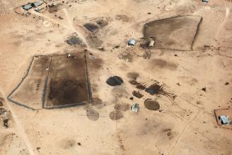
Today: The mosque, school, and around 55 houses—mostly
deserted, with some inhabited by Jewish families—remain on the site. In the
intervening years, homeless people, drug addicts, and even a gang of Jewish
extremists who planned to bomb the Temple Mount mosques have found refuge in
the empty houses of Lifta.
Official Israeli name: Mei Neftoaḥ (the biblical name
identified with the place).
The Arabic name, Lifta, appears on some contemporary maps of
Israel.
From the publication The
Erasure Trilogy, Volume I: Memory Trace (Göttingen:
Steidl, 2015).
ProvenanceThe artist; [Pace/MacGill Gallery, New York]; purchased by MFAH, 2017.
Inscriptions, Signatures and Marks
LIFTA - JERUSALEM DISTRICT / MEMORY TRACE SERIES / 2012 / © (signature)
[no inscriptions]
Cataloguing data may change with further research.
If you have questions about this work of art or the MFAH Online Collection please contact us.